Adding yor own CSV layers
Bettermaps allow you to add your own CSV layers. In a CSV you can use the columns for stroring a list of coordinates representing locations.
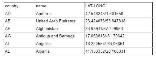
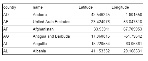
This locations can be stored in one or two columns with their unique name and using the Coordinate Reference System (CRS) WGS84.
Examples:


Adding a CSV
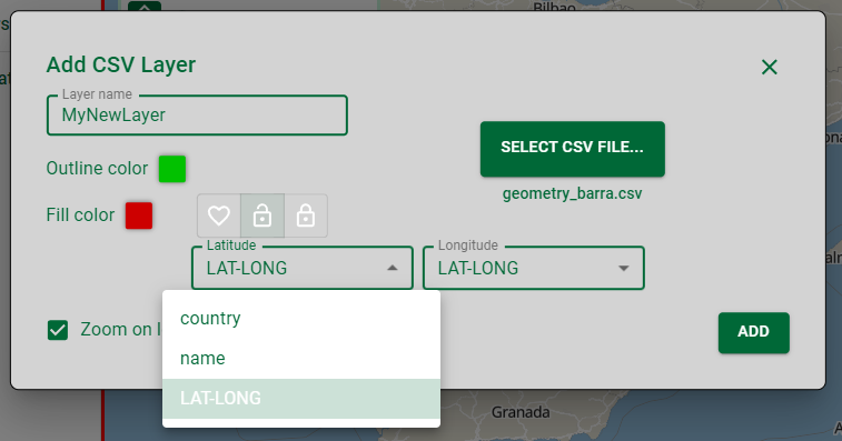
On the actions bar click on the button CSV and a new modal will open. Let's select your own CSV layer.

The user can choose a name for the new layer and edit the style. For selecting the geometry fields choose the columns representing latitude and longitude. If they are in the same column select the same column twice, taking into account that the order of the coordinates is latitude, longitude. The CSV will be automatically transformed into a geojson format and stored in your layers.